Посещение Kurodake
Полезная информация для планирования вашего визита в %{resort_name}
- Сезон открывается28 Nov 2026
- Сезон закрывается 9 May 2027
- Размещение—
- Рестораны | Бары— | —
- Ближайшие аэропорты —
- Ближайшая ж/д станция Kamikawa
- Страница информации о курорте
- телефон для информации+81 / 1658 / 53031
- Информация о лавинах:
Характеристики Kurodake
Территория Kurodake включает:
- Хаф-пайпыNo
- Парк для трюков—
- Кросс-кантри—
- Прокат горнолыжного оборудования—
Какая погода в курорте Kurodake
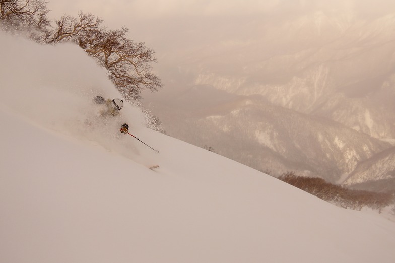
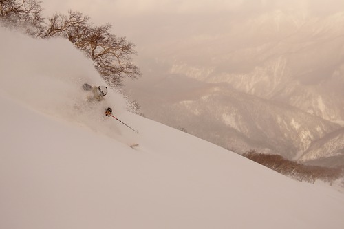
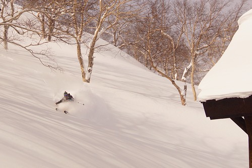
Kurodake (meaning Black Mountain) rises up above Sounkyo town in north central Hokkaido. The area forms part of the Daisetsuzan National park and is home to Hokkaido's tallest mountains. Along with skiers, the resort area also attracts a large number of sightseers who visit to see the impressive Sounkyo gorge, spectacular mountain scenery and the town's annual winter ice festival. The ski area only has two lifts; the first is the Kurodake ropeway which ascends approximately 600m above the valley floor up to 1300m. This is the steepest and most heavily forested portion of the mountain but if you look for it, there are some incredible lines to be had through this zone. There is one semi-marked run from the top of the ropeway to the valley but it is not groomed. Route finding can be difficult as there are many unmarked hazards, no avalanche control and no ski patrol. If you choose to ride the ropeway, please ride with caution and select your route carefully. Above the ropeway, there is a short, double chairlift which ascends a much lower angle slope than the ropeway up to 1560m and offers two groomed piste runs along with access to a mellow powder bowl. Given the nature of this resort, everything outside of its 2 groomed pistes should be considered backcountry terrain and treated with the appropriate respect. If you are uncomfortable accepting these risks on your own, please contact one of the local guiding companies to help you safely explore the area.

Познакомьтесь с расположением Kurodake на карте
Интерактивная карта маршрутов и трасс Kurodake. Изучите трассы и маршруты, а также окружающую территорию и контуры рельефа. Найдите близлежащие курорты и сравните их, кликая на символах курортов.

Какой месяц отличается наибольшим количеством выпадающего снега в Kurodake?

Отзывы посетителей курорта Kurodake
Курорты, близкие к Kurodake
Откройте для себя снежные курорты вблизи Kurodake. Нажмите ниже, чтобы посмотреть справочники по снежным курортам.
 AsahidakeПоследний снегопад: 1.0 cm Wed 10 Jun
 Подъемники: 1
 Трассы: —10 km расст.
- Shirogane Ski Highland Parkhill ValleyПоследний снегопад: 2.0 cm Sat 09 MayПодъемники: 1Трассы: 433 km расст.
- Biei ChominПоследний снегопад: 3.0 cm Mon 04 MayПодъемники: 2Трассы: 339 km расст.
- PippuПоследний снегопад: 1.0 cm Sat 09 MayПодъемники: 3Трассы: 1042 km расст.
- Nukabira OnsenПоследний снегопад: 3.0 cm Mon 04 MayПодъемники: 4Трассы: 943 km расст.
 Nearest