
Посещение Mount Damavand
Полезная информация для планирования вашего визита в %{resort_name}
- Сезон открывается15 Dec 2025
- Сезон закрывается 1 Apr 2026
- Размещение—
- Рестораны | Бары— | —
- Ближайшие аэропорты Tehran (Imam Khomeini Airport)
- Ближайшая ж/д станция Tehran
- Страница информации о курорте
- телефон для информации+98 9121062734
Характеристики Mount Damavand
Территория Mount Damavand включает:
- Хаф-пайпы—
- Парк для трюков—
- Кросс-кантри—
- Прокат горнолыжного оборудования—
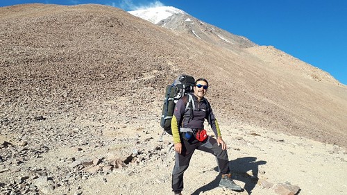
What's it like at Mount Damavand?
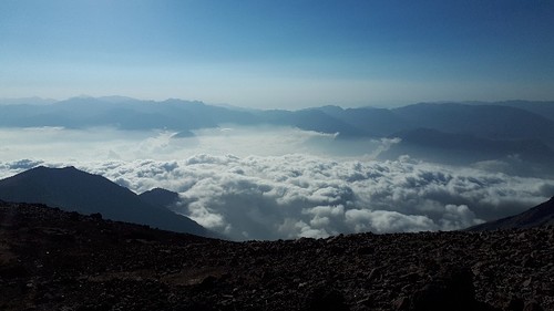
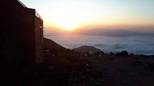
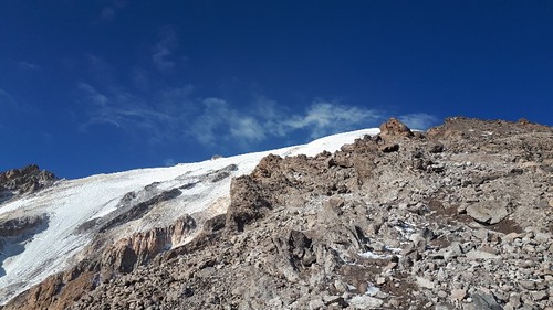
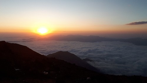
Mount Damavand in Iran (Islamic Republic of) is a small ski resort with no ski lifts but it does boast a very impressive 1524 metres (5000 feet) of vertical descent. The closest airport is at Tehran (Mehrabad Airport) and the transfer time is only 1 hours. The nearest train station to Mount Damavand is at Tehran.
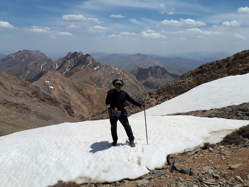
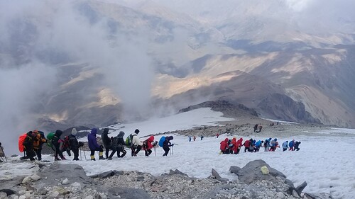
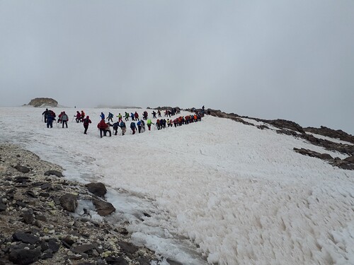
The area has a famous climbing path & shelters: 1-South Ridge: 3rd Shelter (200 persons), 2-West Ridge: Simorq Shelter (40 persons), 3-North-East Ridge:Takhteh Fereidoun Shelter (30 persons), 4-North Ridge: 4000 & 5000 Shelters (15 persons each one), * In summer (high season of climbing) it is hard to find empty place in shelters and taking a tent is recommended. ** shelters have only few wooden beds (north has nothing) and no more facilities. There are 2 camps for arrival date in Reineh (close to south) and Polour (close to west) and also you can rent local suites in Reineh city. * Hot spa is very close to Reineh city. **Iran Mountaineering Federation agent charges foreign climbers in base camps (about 50US$).
Познакомьтесь с расположением Mount Damavand на карте
Интерактивная карта маршрутов и трасс Mount Damavand. Изучите трассы и маршруты, а также окружающую территорию и контуры рельефа. Найдите близлежащие курорты и сравните их, кликая на символах курортов.

Какой месяц отличается наибольшим количеством выпадающего снега в Mount Damavand?
Какое сейчас состояние снега в Mount Damavand?
Справка о текущем состоянии снега в Mount Damavand. Узнайте подробности о Mount Damavand: детальные погодные наблюдения.
- Состояние трасс—
- Условия вне трасс—

| Снежный покров наверху: | ||
|---|---|---|
| Снежный покров внизу: | ||
Отзывы посетителей курорта Mount Damavand
Behzad Karimmaslak из Iran пишет:
I have climbed to Damavand summit from all four main routes but I prescribed for mountaineers that they want to climb for the first time to any route they must have a coach or a very experienced man in his / her team and have accommodated with physical readiness then start to climbing as example 'the eastern route' have the most climbing distance and also in foggy climates the most danger is to be thrown off to 'Yakhar valley'. 'The northern route' program it is better to reach '5000 Shelter'. The end shelter in the first time and have enough water and also have crampon for transferring the glassier. The western route has the most slope and danger of throwing rocks and needs the most physical readiness at the end. 'The southern route' has the most visitors/climbers so it needs preparations to reserve a bed via net.
Смотрите следующие 20 отзывов о Mount Damavand или оставьте собственный
Курорты, близкие к Mount Damavand
Откройте для себя снежные курорты вблизи Mount Damavand. Нажмите ниже, чтобы посмотреть справочники по снежным курортам.
 Āb AlīПоследний снегопад: 3.0 cm Mon 13 Apr
 Подъемники: 9
 Трассы: —25 km расст.
- ShemshakПоследний снегопад: 4.0 cm Mon 20 AprПодъемники: 7Трассы: —55 km расст.
- DarbandsarПоследний снегопад: 2.0 cm Wed 20 MayПодъемники: 6Трассы: —57 km расст.
- DizinПоследний снегопад: 2.0 cm Wed 20 MayПодъемники: 13Трассы: 2368 km расст.
- TochalПоследний снегопад: 7.0 cm Mon 13 AprПодъемники: 4Трассы: 273 km расст.
 Nearest